Mount Bonaparte Lookout
US 160, WA 20
Mount Bonaparte Lookout
Lookout Details
| Registry Numbers | US 160, WA 20 (view other lookouts in United States, Washington) |
| Date Registered | February 5, 1996 |
| Nominated by | Ray Kresek, Washington Registrar |
| Location |
Okanogan National Forest Okanogan County, Washington |
| Coordinates |
N 48° 47.107' W 119° 07.323' (view using Google Maps) N 48° 47' 06" W 119° 07' 19" N 48.785120° W 119.122057° |
| Elevation | 7,215 ft (2,199 m) |
| Administered by | U.S. Forest Service |
| Cooperators | Tonasket Ranger District |
Description
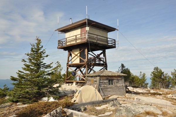
Mt. Bonaparte on the Okanogan National Forest in north central Washington may have been used as early as 1906 as a tent camp lookout. The first 12' x 12' flat-hewn tapered wall groundhouse with tower was constructed in 1914 and the house portion remains today as a storage building. The present 15' x 15' R-6 flattop cab and catwalk on a 20' timber tower was built in 1963 and remains in active service.
Map
Change Basemap