Mendota Fire Tower
US 1033, VA 13
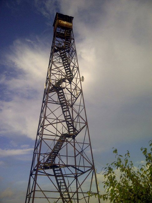
Kristin Scholetzky photo
Lookout Details
| Registry Numbers | US 1033, VA 13 (view other lookouts in United States, Virginia) |
| Date Registered | September 3, 2014 |
| Nominated by | Kristin Scholetzky |
| Location | Washington County, Virginia |
| Coordinates |
N 36° 43.833' W 082° 18.033' (view using Google Maps) N 36° 43' 50" W 082° 18' 02" N 36.730556° W 082.300556° |
| Elevation | 2,976 ft (907 m) |
Description
Mendota Fire Tower sits atop Clinch Mountain, in Washington County, VA. It is a 100-foot steel tower. No longer manned, it is mainly a hot spot for birdwatching as well as a hiking destination for many. Its sister tower, Hayters Knob, is down the Clinch Mountain ridge from it.
Map
Change Basemap